
Soil
Subsoil geophysical imaging to characterize soil moisture and hydraulic properties where point sensors and optical remote sensing fall short.
- Electrical Resistivity Tomography (ERT) and Electromagnetic (EM) mapping at all field sites
- Low-cost, open-hardware micro-Ohmpi sensors for permanent field deployment
- Partitioning of soil fluxes such as sorption
- Training datasets and code converting electrical resistivity into soil hydraulic properties — matric potential (Ψsoil), saturated hydraulic conductivity (Ks) and fluxes (Q)
- Long-term, multi-scale monitoring of key components of the Earth's Critical Zone
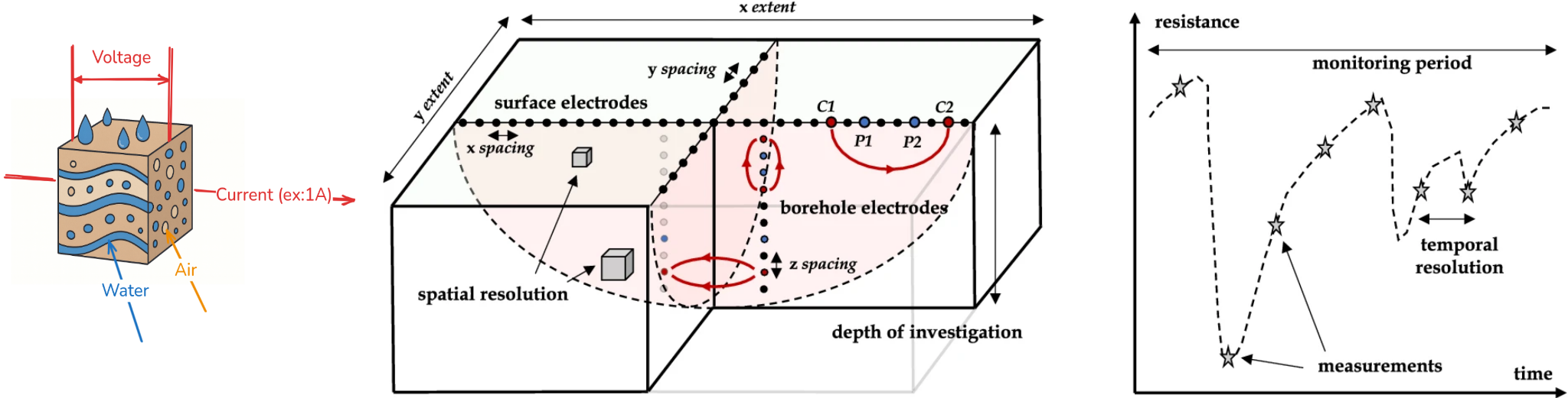
This work package addresses the current gap in experimental trials within complex agroecosystems that lack deep subsoil ancillary information by implementing advanced subsoil imaging techniques. WP1 specifically tackles the urgent need to develop a robust scientific basis for time-lapse geophysical soil mapping, overcoming the limitations of point sensors in spatially characterizing soil moisture variability and compensating for periods when optical remote sensing is unavailable due to cloud cover.
At all field sites, Tech4Agro-CSIC will conduct ground geophysics activities using Electrical Resistivity Tomography (ERT) and Electromagnetic (EM) Mapping, both of which allow detailed modeling of subsoil electrical conductivity. Although geophysics has demonstrated its usefulness in diverse contexts, from mountain hydrology to agronomy and ecology, a systematic prospection strategy for complex, layered agroecosystems is still lacking. The recent creation of open-hardware instruments has reduced costs and now enables the permanent deployment of sensors in the field, opening new opportunities for this project.
Contents